Gibraltar and Brexit

When I switched on the tv to watch the returns for the EU referendum on the evening of 23 June, the first voting area to report its result was Gibraltar.  The numbers were read off: 19,322 votes for Remain, 823 votes for Leave, with a turnout of 83.5%.

With 95.9% of the vote, Gibraltar was the top area of support for Remain.

United Kingdom EU referendum 2016 area results.svg

Map Credit: wikimedia commons

While the end result of the overall vote certainly captured my attention that day and subsequently, my interest was still piqued for what the Brexit result would mean for Gibraltar.

Gibraltar is one of fourteen remaining British Overseas Territories, under British control since the 1713 Treaty of Utrecht.  Early on, it was conquered successively by the Phoenicians, Carthaginians, Romans, Vandals, and Visigoths, who each valued its strategic location on the Mediterranean Sea.  Islamic forces conquered Gibraltar as part of the conquest of Iberia, in 711; Spain retook control in 1462.

During the War of Spanish Succession, Gibraltar was captured from the Spanish and ceded to the British, who faced down subsequent sieges by Spain and consolidated their control by 1784.

Spain has continually disputed the status of Gibraltar as a British territory, making this the crucial element of how Brexit will impact the territory.

Even before the referendum, José Manuel García-Margallo (Spain’s acting Foreign Minister) remarked that it was “perfectly possible” for Spain to close the border with Gibraltar if the UK left the European Union, although he also stated that this was not something the Spanish government had specifically considered.  The border with Spain had previously been closed between 1969 and 1985, only fully reopening when Spain joined the European Community.  García-Margallo also told Spanish National Radio that if Britain were to leave the EU, “we would be talking about Gibraltar the very next day.”

In 2002, Gibraltar voted overwhelmingly to reject a proposal to share sovereignty with Spain.  Now, many in Gibraltar see the EU as a force that aids in keeping a positive relationship with the Spanish.  With Spain in control of its only land border, freedom of movement could be at stake, as about 10,000 people cross the border with Spain for work each day.  And the question of sovereignty also will continue to surface.  After the Brexit vote, García-Margallo stated, “The Spanish flag on the Rock is much closer than before.”

Fabian Picardo, the Chief Minister of Gibraltar, dismissed the idea of a change in sovereignty but has pursued a separate deal to keep Gibraltar in the EU.

What will it mean for this part of Britain on the European mainland to no longer be part of the European Union?  How open will the border with Spain remain when it is no longer an EU border?  And how will this impact the lives and identity of the people of Gibraltar in the long run?

H800 Technology-Enhanced Learning: Reflections

H800 Technology-Enhanced Learning: Reflections

I recently finished an online postgraduate course on technology-enhanced learning that forms part of the Open University‘s Online and Distance Education postgraduate programme. This module introduced students to the key texts, terms, and debates when it comes to technology-enhanced learning from both the practitioners’ and students’ perspectives. One of its greatest strengths was that built into the class were opportunities to seek out new technologies and apply what we were learning and finding to our own unique circumstances.

The Open University’s H800 students were from all over the world and in a wide range of professions, including teachers and educators from all levels as well as tech professionals in higher education and the private sector. It was a great mix and we’ve all learned a lot from one another as well as from the course materials. One of the things that surprised me most was the strong sense of community that developed outside of the module’s Virtual Learning Environment (VLE), the online course area provided by the Open University.

While we were provided with online forums and the ability to video chat with fellow students within the VLE, more than two dozen of us migrated many of our conversations and discussions to a private Facebook page. I also connected with fellow students via Facebook Messenger and Google Hangouts on my computer and mobile phone. I think this reflects several of the goals of the module: 1) Introduce us to a range of technologies; 2) Apply these to our own work; 3) Take ownership of our learning; and 4) Create a supportive community of practice.

Not only have I begun to use new technologies to meet a range of needs for my informal and formal learning and work as a practitioner, but I now have connections to individuals with a range of expertise that I could draw upon in the future. For example, I’ve already spoken with a few about developing the Moodle (VLE) for Slavery in the Americas that’s starting soon. I also think that as some of my posts over the past few months have demonstrated, I’ve begun to look differently at some of the technologies that I was already using in new ways, such as for informal learning, teaching potential, supporting communication, online community building, etc.

H800, Technology-enhanced learning, was as much about teaching and learning theory and debates as it was about the technology. This has been very helpful. I’ve been introduced to the language, the techniques, and the research that underpins much of the teaching and innovations that are taking place in universities across the western world. Its been eye-opening. For example, I’m excited about the possibilities of making the ‘flipped classroom’ (where instructors film their lectures to be provided to students online ahead of class so that class time can be devoted to interactive activities such as problem solving, group work, and support) a common site on university campuses.

I’m now understanding why universities and their libraries are refurbishing to provide social spaces within their buildings and providing better Wi-Fi capacity. Both the University of Glasgow and the University of Edinburgh, for example, have revamped their main libraries to encourage and facilitate technology-enhanced group work and discussion. I’m also intrigued by the controversy over whether the ‘Google generation’/ millennials are really all that different from other ‘generations’. Do they learn differently and require different teaching strategies from their instructors than previous students? Or is it all hype? Seeing as by some definitions I am a millennial, it’s an interesting thought!

I took on H800 for general professional development and to strengthen my online course creation skills. I’m coming away with a strong understanding of current teaching and learning theory and practices, awareness of the possibilities of new and existing technologies for teaching and learning, and some great connections and good friends. It’s been a good, intense 32 weeks!


Postcard from Drumburgh

Postcard from Drumburgh
img_0095

Hadrian’s Wall, Drumburgh – Photo credit: Paula Dumas

These photos are from just outside the town of Drumburgh, along the most western section of Hadrian’s Wall. In the medieval period, Drumburgh was a prime location for the English to look out for regular waves of Scottish raiders thanks to its flat, marshy lands, fortified farmhouse, and views of the Scottish borders.

img_0099

Sheep near Drumburgh — Photo credit: Paula Dumas

img_20160827_104121

Hadrian’s Wall, Drumburgh — Photo credit: Paula Dumas

The Irish in a Colorado Mining Town: A Look at Leadville

SAMSUNG CAMERA PICTURES

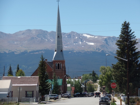
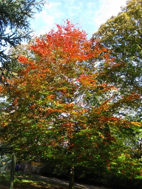
Church of the Annunciation, Leadville, CO – photo credit: L. Flewelling

In the nineteenth century, the Irish were the second largest foreign-born ethnic group in Colorado, with the major sites of Irish settlement at Denver, Leadville, and Cripple Creek. The earliest Irish migrants in Colorado were miners, railroad workers, soldiers, and domestic servants.  In Denver, many Irish worked as common laborers.

In 1877, miners in Lake County realized that the black sand they had been tossing off to the side when looking for gold was actually silver.  This led to a silver boom, causing the city of Leadville to spring up overnight.  By far the largest ethnic group in Leadville was the Irish, and Leadville became the most Irish city in the Rocky Mountain region by 1880.  About 9% of the population had been born in Ireland and another 7% were second generation Irish Americans.  The majority of Irish were miners, and like most groups in Colorado at this time, were mostly men.

Irish women in Leadville were housewives, domestic servants, laundresses, about six were prostitutes, and there were also several nuns who worked as nurses at St Vincent’s Hospital.

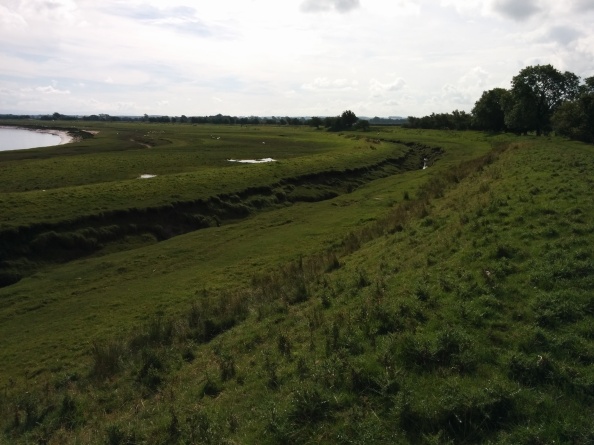
In Leadville, the Irish mainly settled on the east side of town, with 6th street as the main thoroughfare.  Because they were the largest ethnic group, they had a large impact on the town as it grew.  They had their own Catholic church, the Church of the Annunciation, which was founded in 1879.  There was also St Vincent’s Hospital and St Mary’s Catholic School.  The names of the mines also reflect the Irish presence.  Many of them are name after people or groups from Irish nationalism: Robert Emmet, Wolfe Tone, O’Donovan Rossa, Fenian Queen, and Charles Stewart Parnell.  Others have more general Irish cultural links: O’Sullivan, Murphy, Fitzjames, Letterkenny, Mary Murphy, Red-Headed Mary, Seamus O’Brien, Fitzhugh, Donovan, O’Brien, and Maid of Erin.

The most well-known people of Leadville were also Irish.  Molly Brown and her husband J.J. were the children of Irish immigrants.  Baby Doe Tabor, whose birth name was Elizabeth McCourt, was also the daughter of Irish immigrants.  Her husband, Colorado Lieutenant Governor Horace Tabor, was known to support the Irish nationalist movement.

Irish nationalism was a huge cause for the Irish immigrants in Leadville.  Nationally, Leadville ranked third in money donated to the Irish Land League, behind only Philadelphia and Chicago.  Leadville formed its own branches of the Land League and the Ladies’ Land League, and also had other Irish societies, the Knights of Robert Emmet, the Ancient Order of Hibernians, and the Daughters of Erin.  The Irish also had their own local militai, the Wolfe Tone Guards.

Both Leadville and Denver’s Irish populations were well-organized and supportive of nationalist causes, and this led several Irish nationalists to include both cities in their fundraising tours of the United States.  This included two visits by the founder of the Land League, Michael Davitt, as well as the treasurer and secretary of the Land League and several members of the Irish Parliamentary Party.  Oscar Wilde also came to Denver and Leadville in 1882.  He gave a talk on art and aesthetics to the miners at the Tabor Opera House and became legendary in the area for the amount of whiskey he consumed.

Along with their nationalist activism, the Irish in Leadville were known for their participation in local labor movements.  They were associated with the leadership of two major strikes in Leadville, the first a 23-day strike in 1880 and the second a much longer strike from 19 June 1896 to 9 March 1897.  Labor activism fit well with Irish land agitation and calls for self-government.  In fact all three of these movements had been tied together through the most prominent Irish American newspaper, the Irish World.  The newspaper’s founder and editor, Patrick Ford, promoted Irish nationalism and American labor activism, and his paper was circulated around the country, even to places as distant as Leadville before it had railroad access.

In both of the Leadville strikes, the miners’ unions were led by Irish miners, demanding higher pay and shorter working days.  In both cases, the strikes were put down by the Colorado National Guard.  While the 1880 strike was peaceful, the 1896 strike became violent, with armed strikers attacking the mines.  At least eight miners were killed.

In 1896, Leadville’s branch of the Loyal Orange Institution was founded.  In North America, the Orange Order had a by far larger presence in Canada, with a weaker organization in the United States.  In Colorado, the oldest and largest Orange presence was in Denver.  The timing of the foundation of the Orange lodge in Leadville is interesting, as the population of Leadville had been drastically declining since the 1893 silver crash.  So why would smaller numbers of people want to form a new organization at this time?  It’s possible that the Irish and Scotch-Irish Protestants were attempting to dissociate themselves from the Irish Americans who were leading the miners’ strike, who they would have considered radical, extreme, and at the bottom of the social ladder.

The Orange lodge in Cripple Creek was also founded soon after the Cripple Creek miners’ strike, which was also heavily associated with Irish American-led labor agitation.

It’s difficult to track just low large of a presence the Orange Order and other Scotch-Irish migrants would have had in Colorado, because the peak of emigration from Ireland was farther in the past.  They might be lumped in with second-generation Irish Americans from Canada, Pennsylvania, New York, and Michigan, where the Orange Order was strongest.

After the silver crash of 1893 and the strike of 1896, the productivity and population of Leadville declined drastically.  In 1900, 8,900 people lived there, and by 1910, it was down to 4,400.  Many of the Irish miners moved on to different mines in the west, while others moved to Denver.  By 1910, 44% of the Irish in Colorado lived in Denver, part of the total of 63% of the Irish population living on the Front Range.  Those who remained in Colorado were more urban and middle class than the working class miners.

The Irish in Colorado continued to be active in the labor movement, including the leaders of the Cripple Creek miners’ strike in 1903-4 and Mary Harris Jones, known as “Mother Jones,” who was born in County Cork and was active in supporting miners during the Ludlow Massacre.  The Irish worked in the coal mines along the Front Range, became police officers and firefighters in Denver, supported the expanding Catholic church in the region, and continued to participate in fraternal societies such as the Knights of Columbus.  Éamon de Valera, the president of the Irish parliament, visited Denver as part of his fundraising tour of the United States in 1919, highlighting continued support for Irish nationalism.

Additional Readings:

David M. Emmons, Beyond the American Pale: The Irish in the West, 1845-1910 (Norman: University of Oklahoma Press, 2010).

Dennis Gallagher, Thomas J. Noel, and James Patrick Walsh, Irish Denver (Charleston: Arcadia, 2012).

James Patrick Walsh, Michael Mooney and the Leadville Irish: Respectability and Resistance at 10,200 Feet, 1875-1900 (Unpublished PhD Thesis, University of Colorado Boulder, 2010).

Sources 101: The Legacies of British Slave-ownership database

UCL’s Legacies of British Slave-ownership project holds a lot of promise for historians of British slavery and abolition. It contains vital details and evidence of slave ownership within Britain at the end of slavery in the British Empire. Several academic publications have already come out of the project detailing the extent of slaveholding and financial ramifications of the compensation granted to slaveholders as part of the abolition settlement in 1833. In the summer of 2015, the television channel BBC Two aired a two-part documentary in the UK that examined some of the project’s early findings. This brought the project (and, to some extent, Britain’s slave-owning past) into the public eye. For today’s post, I wanted to go back to the database and share some tips for getting started and making the most of this great resource.

screen-shot-2016-09-11-at-15-30-45

History:

Legacies of British Slave-ownership (LBS) was an ESRC-funded research project based at UCL that ran from 2009 to 2012. The project employed ten staff members and resulted in the creation of an online encyclopaedia of British slave owners as of 1833. On the project website it is noted that the project is not concerned with the identities of the enslaved individuals; such registers are found in the British National Archives. Some of the researchers on the Legacies of British Slave-ownership then moved on to work on the ESRC- and AHRC-funded project, Structure and Significance of British Caribbean Slave-ownership 1763-1833 (also at UCL), which looked at the histories of the slaveowners and the plantations.

What You’ll Find:

The Legacies of British Slave-ownership database is a digitised, searchable version of the Slave Compensation Commission’s records. This Commission was set up in the 1830s to settle the compensation claims of approximately 46,000 British slave holders whose private property in slaves had been taken by the British Government through abolition. These compensation records were then supplemented where possible with biographical information submitted by researchers and developed at workshops that were held across the UK over several years. I was lucky enough to attend one at the Kelvingrove Art Gallery and Museum, Glasgow, back in 2010. These elements have combined to turn the database into an online encyclopaedia.

The Legacies of British Slave-ownership website contains details about the research project and its staff, the searchable database with both simple and advanced search options, a form for researchers and historians to send in relevant information on slave owners that they may wish to see added to the database, a list of related publications, and a link to the project’s blog which was last updated in late 2015. Finally, it contains multiple lists of “legacies“: slaveholders who had recognised ties to British commercial, political, imperial, historical, physical, and cultural ventures. It is in these lists that we finally get a sense of the real legacies of British slaveholding.

How to Use It:

Along the right-hand side of the project’s main page contains a large blue box labelled “Search the Database”. This simple search asks you to specify whether you wish to search by an individual’s name, the name of a firm/business, an address, or for something in the notes. Alternatively, clicking on “Search the Database” in the bar along the top of the site takes you directly to the Advanced Search page. Here you’ll find a wide range of potential areas within which to search. You can search by name, sex, role in the claim, location, education, religion, birthday, wealth, residence, and claim details (such as the location of the claimant’s plantation(s)). With such a large number of inputs, I highly recommend visiting the Search Guidance Notes for more information on how to search (including the use of wildcards) and some of the results you can expect to receive from your search words.

To skip searching for individuals or keywords and go directly to the categorised legacies results, click on the category that interests you from the drop-down menu under the header, “Browse the Legacies“, that you’ll find next to “Search the Database” along the top of the page or in the orange box below the “How You Can Help” section on the front page of the project.

Research Potential:

The Legacies of British Slave-ownership database has led to several books and articles listed on their website. There are a number of areas of research that may stem from this resource. First, we are able to see and map where slaveowners lived. Some early mapping has been done for areas of London using Google Maps. Second, we can find out more about how 19th century British businesses and institutions made their money. If, like me, you are interested in understanding the West Indian interest’s fight against abolition in the 1830s, knowing the size and make up of the interest is vital. The records reveal who people were, their money and property, their location, and their connections. There is much more to do to fully utilise these records.

Reflections:

One of the great strengths of this project was that the historians working on this project set out to utilise the knowledge of researchers across Britain to supplement the material contained within the specific records that were being digitised. They travelled around the country, bringing local researchers into their circle and drawing attention to the project in its early stages. They made it easy for historians to contribute information to the encyclopaedia via their “How You Can Help” form. They gained public attention through their television appearances (for example, Britain’s Forgotten Slave Owners received a BAFTA in May 2016). And they put the raw data as well as this supplementary information and specialised lists online as a free resource.

Former ties to slavery are making big news in the United States and elsewhere (for example, see the ongoing news items about Georgetown University‘s plans for reconciliation). The need for reparations from institutions and from governments is a pressing, vital issue for many people around the world. Those of us studying the lives, work, and culture of planters within Britain are well aware of the legacy of slaveholding in the buildings, industries, businesses and institutions in our areas. By sharing this information with the wider world, we are not only informing the public about the past (as the Legacies of British Slave-ownership has done), but we can encourage change in the future.

More Maps: On the 350th Anniversary of the Great Fire of London

There I did see the houses at that end of the bridge all on fire, and an infinite great fire on this and the other side end of the bridge…. So down, with my heart full of trouble, to the Lieutenant of the Tower, who tells me that it begun this morning in the King’d baker’s house in Pudding-lane, and that it hath burned St. Magnus’s Church and most part of Fish-street already.  So I down to the water-side, and there got a boat and through bridge, and there saw a lamentable fire…. Having staid, and in an horu’s time seen the fire rage every way, and nobody to my sight, endeavouring to quench it, but to remove their goods, and leave all to the fire.

-Samuel Pepys

greatfire120maps20k20top2021203620a

Hollar’s Great Fire of London Maps – source credit: British Library

Three hundred fifty years ago this month, the Great Fire of London destroyed much of the medieval city.  Here we have the panoramic views of London created by Prague-born artist and cartographer Wenceslaus Hollar.  As the British Library describes, Hollar copied a view of London that he had completed in the 1640s to illustrate London before the fire, and used knowledge gained from his official work mapping the damage to create the scene of destruction.  Zooming in on the image, we can see the flattened and destroyed buildings, and St. Paul’s with its roof caved in just as described in Pepys’ famous account of the Great Fire.

Walked thence, and saw all the towne burned, and a miserable sight of Paul’s church, with all the roofs fallen, and the body of the quire fallen into St. Fayth’s; Paul’s school also, Ludgate, and Fleet-street, my father’s house, and the church, and a good part of the Temple the like.

-Samuel Pepys

Interesting, the British Library discusses how the panoramic view of London from the south across the Thames was a traditional depiction by artists and cartographers since the 1540s, lasting until the mid-19th century when aerial views became the more common depiction.

map-london-gutted-1666

Hollar’s Map of London, 1667 – source credit: wikimedia commons

Hollar also created this overhead view of London.  We can see the footprint of St Paul’s, and the place the fire started on Pudding Lane near London Bridge (where the monument to the Great Fire is now).  Hollar moved to England in 1637 and stayed in London until 1642, when he left for Antwerp.  He returned to England in 1652 and lived there until his death in 1677.  He was extremely productive, creating about 2700 etchings during his life.

Here is a digital collections of Hollar’s works from the University of Toronto and prints by Hollar at the British Museum.  Here is his page on Google Arts and Culture.

wrensplanandviews-l

Wren’s Plan for Rebuilding London – source credit: British Library

Christopher Wren’s plans for rebuilding the city after the fire, one of the first proposals to be submitted, utilized Hollar’s panoramic views to highlight suggested changes to the medieval city – with buildings plotted in orderly fashion, wide avenues, and open piazzas.  Wren’s plans were never used, but he was of course able to make his mark on the rebuilt cityscape.

Round up of sources on the 350th anniversary of the Great Fire of London:

We staid till, it being darkish, we saw the fire as only one entire arch of fire from this to the other side of the bridge, and in a bow up the hill for an arch of above a mile long: it made me weep to see it.

-Samuel Pepys

British Planters Abroad: Autumn Reading List Edition

British Planters Abroad: Autumn Reading List Edition

A few months ago I wrote up an introduction to the historiography of British abolition in the form of a summer reading list. With the new term upon us and students of all ages excitedly heading back to school (including my little sister who is starting university!), it seemed like the perfect time to create another such survey of monographs related to slavery and abolition.

1915356_364520810064_5604303_n

Autumn in Edinburgh

This season I’m focussing on British planters in the West Indies. I’ve chosen them as my subject for several reasons:

  1. I’ve studied British planters and their treatment in historical studies for my PhD, ‘Defending the Slave Trade and Slavery in the Era of Abolition, 1783-1833’ (Unpublished PhD thesis, University of Edinburgh, 2013), and my first book, Proslavery Britain: Fighting for Slavery in an Era of Abolition (Palgrave Macmillan, 2016);
  2. Opinions on the size, makeup, and influence of the planters has been the topic of heated debate for almost a century; and
  3. Thanks to recent studies, we can now learn more about the lives of British planters at home and abroad.

You’ll probably notice that several of these studies discuss the ‘decline’ in influence British West Indians experienced before and during the era of abolition (which I tend to define as between 1783, when the first anti-slavery petition was read in the Houses of the British Parliament, and 1833, when the British Parliament legislated for the abolition of slavery in the British Empire). This focus allows historians to use their research to assess why abolition took place when and how it did, but it can also lead to historical narratives that assume that abolition was inevitable (a point which deserves further exploration in its own blog post). This helps justify one’s interest in people who opposed the popular abolition movement. It is also a reaction to and legacy of the first major twentienth century study that focussed on British planters, Lowell Joseph Ragatz’s The Fall of the Planter Class in the British Caribbean, 1763-1833. You’ll find more about his work below.

This reading list is meant as an introduction to the historiography of the subject and is by no means exhaustive. It’d be great to hear your suggestions for additions and your thoughts on the works (or even aspects of slavery and abolition around which you’d like to see a reading list developed!) written in the comments below. You can also tweet us @IslesAbroad.

Ragatz, Lowell Joseph. The Fall of the Planter Class in the British Caribbean, 1763-1833: A Study in Social and Economic History. 1928.

In this early study, Ragatz argued that slavery would have come to an end in the islands regardless of abolition because of moral, social, and economic deterioration, the planters’ loss of political influence, and the unwillingness of colonists to adapt to new progressive farming methods. He addressed the events and influences which led to the decline of the planter class’s influence and wealth. Ragatz put forth an openly judgemental, negative image of the planters throughout the work.

Burnard, Trevor. Mastery, Tyranny, and Desire: Thomas Thistlewood and His Slaves in the Anglo-Jamaican World. Chapel Hill, NC: University of North Carolina Press, 2004.

Mastery, Tyranny, and Desire is an exploration of 40 years of European and African cultures in Jamaica through the lens of a planter’s diary. In his work, Burnard uncovers not only details of life on the plantation, but why Jamaica was seen as a ‘land of opportunity’ (p. 66) for white British colonists. Abolition would therefore have been seen as a threat. I also can’t forget to mention Trevor Burnard’s most recent book, Planters, Merchants, and Slaves: Plantation Societies in British America, 1650-1820 (University of Chicago Press, 2015).

Lambert, David. White Creole Culture, Politics and Identity During the Age of Abolition. Cambridge: Cambridge University Press, 2005.

White Creole Culture, Politics and Identity During the Age of Abolition is concerned with identities and networks. By focussing on Britain’s earliest Caribbean sugar colony, Barbados (colonised in 1627), Lambert looks at how planters worked to define themselves as ‘white’ and ‘British’. Through this study, he shows how these representations were created as a means of defending themselves, their wealth, their system of laws, and their property in slaves in the face of intense opposition from abolitionist efforts back in England.

Petley, Christer. Slaveholders in Jamaica: Colonial Society and Culture During the Era of Abolition. London: Pickering and Chatto, 2009.

In Slaveholders in Jamaica, Christer Petley echoed Ragatz’s theory of planter decline as the reason behind the achievement of abolition in 1833. He argued that by being unwilling to defend slavery using moral arguments at a time when the expanding British empire rendered the West Indian colonies less valuable to the mother country, the West Indian interest in Jamaica and abroad brought about their own loss of influence.

I also want to draw your attention to a relevant special volume of Atlantic Studies that really tackled some of the major arguments about the roles and state of the planters in the era of British abolition. Back in 2010, a number of slavery historians (including myself) gathered at Chawton House Library in Hampshire, England for the ‘Rethinking the Fall of the Planter Class’ one-day conference on British planters, their legacies, and their treatment in the historiography of British slavery and abolition. Speakers frequently spoke about their research into West Indian planters in relation to Ragatz’s work mentioned above.

As a follow-up to the conference, Christer Petley edited a special volume of the journal, Atlantic Studies, which contained articles from several of the authors mentioned above. If you have access to Taylor & Francis online journals (such as through an academic library’s online collections), I highly recommend visiting Atlantic Studies vol. 9 (2012), Rethinking the Fall of the Planter Class.

More Maps: Matthew Paris’ Great Britain

Earlier this summer I looked at using maps as primary sources for class as a way to generate discussion and highlight worldviews of the time periods and cultures in which the maps were created.  One of my favorite maps, and one that would be an excellent source in British History courses, is Matthew Paris’ Map of Great Britain, produced in 1250.  This map is now in the British Library.

britannienkarte_des_matthew_paris

Matthew Paris, Map of Britain (1250) – photo credit: wikimedia commons

Not only is the map visually appealing, particularly in its use of color, drawings of miniature battlements and city walls, and ability to seize the imagination, it is also the oldest surviving map to show such a high level of detail and accuracy.  Over 250 places are identified on the map, with Scotland clearly set apart by Hadrian’s Wall and the Antonine Wall.  I particularly enjoy the depiction of the Firths of Forth and Clyde sharply cutting through Scotland to almost meet.  Scotia and Wallia (with an elaborate Mount “Snaudun”) are identified by name, along with areas such as Devonia and Sufolck. The side bars identify the nearest land in each direction.  London, in the bottom center of the map, appears to have all roads leading to it (notice how the towns line up above it) along with a snake-like Thames.

We can see that the land depicted on the map is distorted, but even with this it was still extremely accurate for its time.  As the British Library site describes, Paris’ depiction was likely based on both travelers’ accounts and Ptolemy’s geography.

Matthew Paris was a monk at St. Alban’s Abbey in England, where he lived all of his adult life.  He was an historian, writer of chronicles, and artist.  Paris drew four maps of Britain, of which this is the most detailed.

Just think about the Hereford Mappa Mundi from my previous maps post.  As Simon Garfield emphasizes in On the Map, Matthew Paris created his map of Great Britain about fifty years before the mappa mundi was produced, making Paris truly stand out as a unique mapmaker of his time.