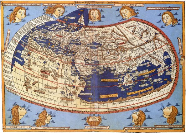
15th Century rendering of Ptolemy’s Map of the World – photo credit: wikimedia commons
One of my favorite sources to spark discussion in class, especially in courses like the Atlantic World, British Empire, and American history, are historic maps. What can maps tell us about how people at the time perceived the world around them? What did the maps prioritize in their depictions of the world? Who created them and what knowledge did they draw upon? How did these views change over time? One of the big benefits to using maps is that they are easily comparable between time periods for students. And they allow students to easily grasp just how huge of an impact the era of explorations had on European conceptions of the world around them.
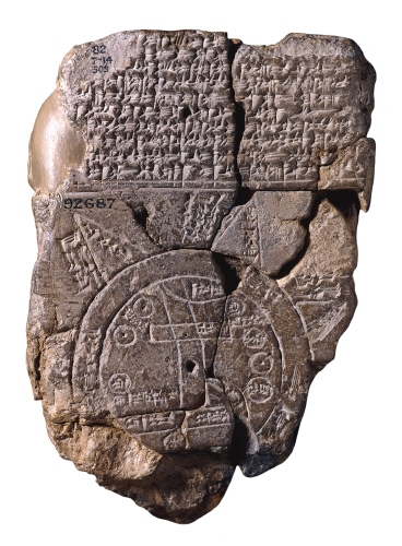
Babylonian Clay Tablet with Map, ca. 600-550 BC, now in the British Museum – photo credit: wikimedia commons
Another benefit of using maps as a basis for class discussion is that it makes clear to students that people in Columbus’s time did not believe that the world was flat (this seems to be a recurring misconception).
Claudius Ptolemy produced his descriptive atlas in Alexandria in the 2nd century, which was still considered one of the best sources for knowledge of world geography by the 15th century. His atlas consisted of a huge list of descriptive coordinates for cities and other known locations, which were then interpreted by mapmakers as seen in the map at the top of the page. As can be seen, Africa and India are distorted, the Mediterranean is overly large and depicted at the center of the map, and the areas within Greece and the Roman Empire are the most accurate. Ptolemy also tended to fill empty spaces on the map with “theoretical conceptions,” rather than leaving unknown areas blank.
After the Library at Alexandria was destroyed, there was little advancement in cartography from the time of Ptolemy. Medieval maps tended to place Jerusalem at the center of the known world, and represented both geographical knowledge of the physical route to Jerusalem as well as a symbolic route for salvation. The Hereford Mappa Mundi, created ca. 1300 and housed at the Hereford Cathedral, is a T-O map with Jerusalem at the center, the East at the top, and Britain and Ireland on the bottom left. Along with cities and towns, the map depicts Biblical events, plants and animals, fantastical creatures, and classical mythology.
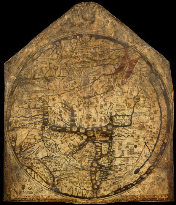
Hereford Mappa Mundi – photo credit: wikimedia commons
Another one of the most notable medieval maps was that created in 1450 by the Venetian monk and cartographer, Fra Mauro (who also has a region of the moon named after him, where Apollo 13 was supposed to land). His map was considered the most detailed and accurate of its time, including Asia, Africa, Europe, and the Atlantic. And you can see that he oriented the map with the South at the top.
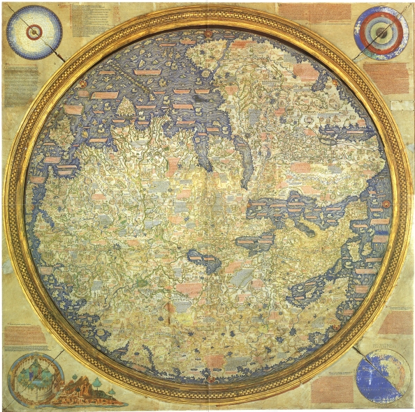
Fra Mauro Map, now at the Museo Correr in Venice – photo credit: wikimedia commons
And finally, we have the 1507 map created by Martin Waldseemüller, the first map to label the newly-discovered continent in the western hemisphere “America.” This map includes knowledge about the coasts of Africa and India from recent explorations and discoveries, and includes a large ocean to the east of Asia: a very early depiction of the Pacific. But the aspect which students are most responsive to is the narrow strip of land encompassing all that was known at the time about North and South America. You can see the detailed east coast and Caribbean, and the hazier depiction of land to the west.
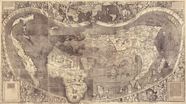
Waldseemüller Map, Universalis Cosmographia, now housed in the Library of Congress – photo credit: Library of Congress
Obviously there are many more historical maps that could be used as examples. But overall, I can’t say enough about how well students respond to maps such as these as the basis for jump-starting class discussion, having students make discoveries that you might not have noticed yourself, and, even if this might all seem rather perfunctory, I find them very fun discussions both as an instructor and for students to help understand how Europeans of different eras envisaged the world around them.
- See also: Simon Garfield, On the Map: A Mind-Expanding Exploration of the Way the World Looks (New York: Gotham, 2013).
